Northeast Highlands See First Snow as Sierra and Rockies Add Heavy Accumulations
Northeast
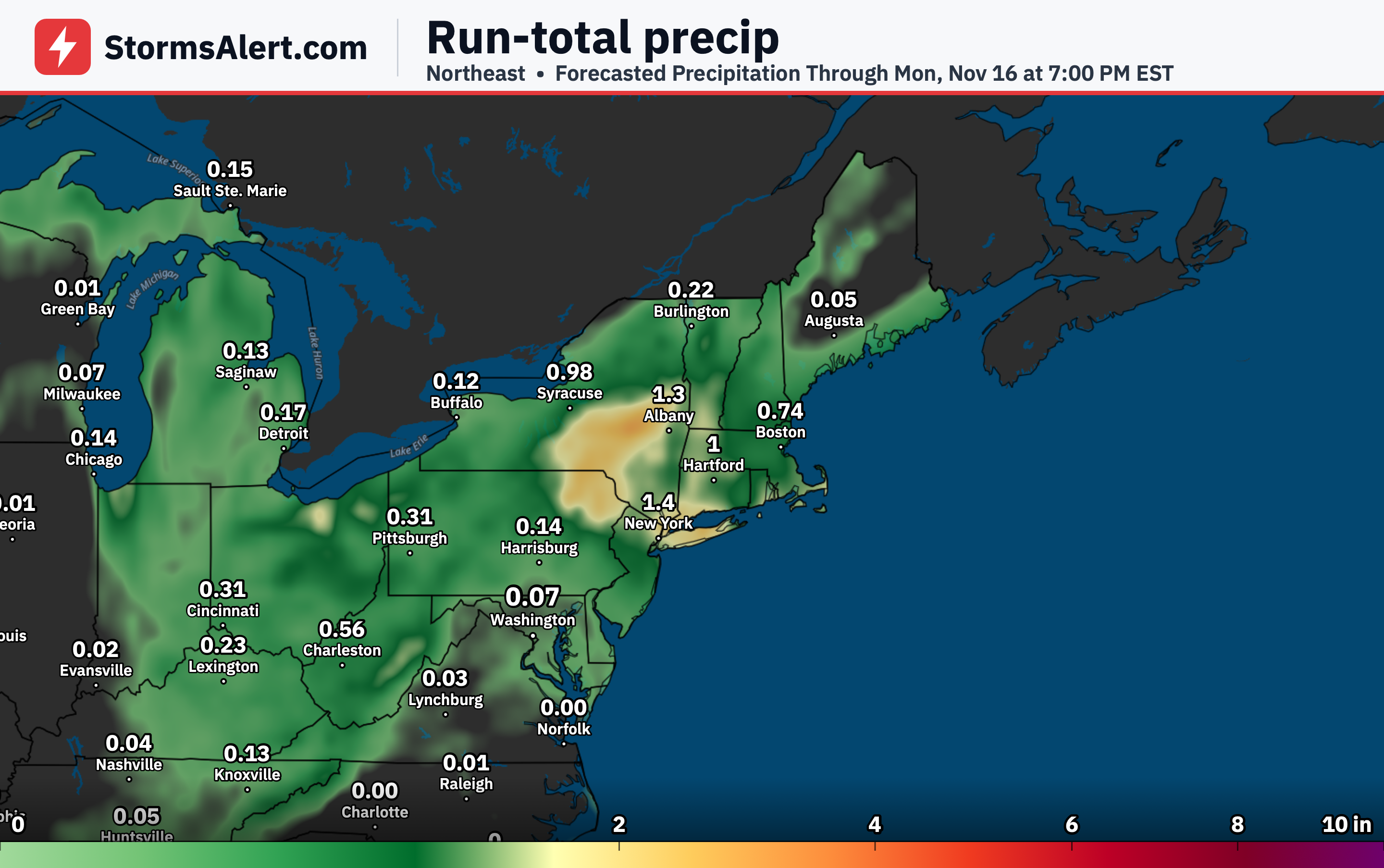
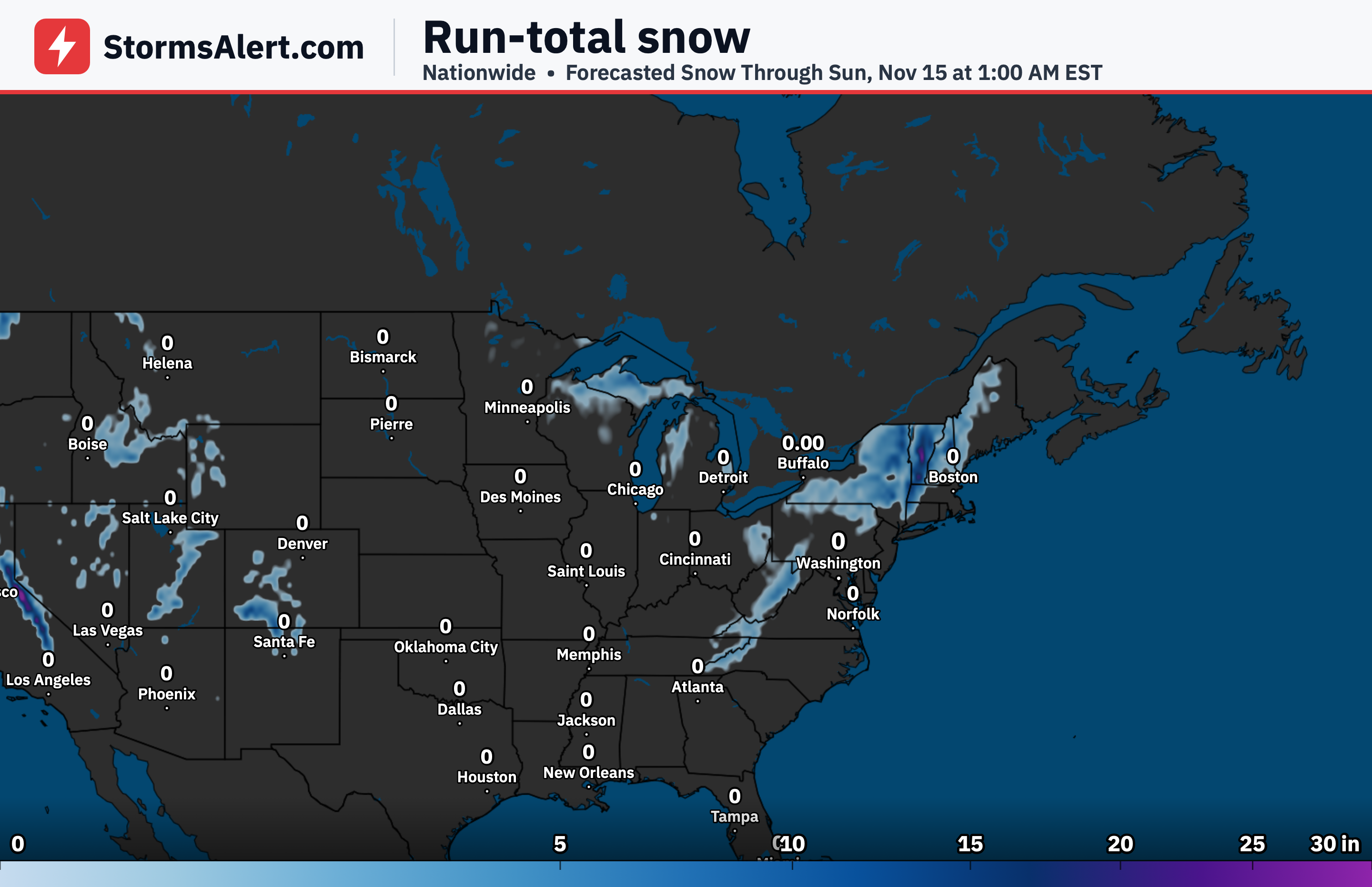
The first widespread accumulating snowfall of the season is expected primarily across the higher elevations of Upstate New York, Pennsylvania, and New England from late Thursday through Saturday morning. Rain will dominate at first and spread as far north as central New England and coastal Maine, with a rain-snow mix only in the highest Adirondacks. Colder air will then lower snow levels, and light accumulating snow becomes possible even in some valleys by Friday morning. A band of heavier snow may develop and pivot from the Catskills and Poconos across eastern Upstate New York into the Litchfield Hills, Berkshires, Worcester Hills, and southern Vermont and New Hampshire, with rates occasionally reaching one inch per hour. Accumulations will stay modest in most valleys, where the chance of at least one inch is only about 10 percent, but the Catskills, Adirondacks, and Green Mountains have a 50 to 80 percent chance of more than four inches. Higher elevations should prepare for slick travel.
Central Appalachians
Farther south, periods of accumulating snow are likely across the Central Appalachians on Friday and Saturday as colder air arrives and upslope flow increases. Snow is most favored above 2,000 feet in West Virginia and above 3,000 feet along the North Carolina-Tennessee border. The chance of at least four inches reaches 40 to 60 percent in those higher spots. The snow will tend to be heavy and wet, which can make driving difficult on mountain roads.
Great Lakes
Cold air streaming over the still-warm Great Lakes will generate lake-effect snow through Saturday. Immediate shorelines will mostly see rain or a rain-snow mix with little accumulation. Inland and higher areas will fare better for snow, with a 30 to 60 percent chance of at least four inches where bands set up south of Lake Michigan into far northeast Illinois and northwest Indiana, near Traverse City in the northwest Lower Peninsula of Michigan, and across much of the Upper Peninsula.
Upper Michigan
The heaviest lake-effect snow will focus on Michigan’s Upper Peninsula. Multiple bands of snow are expected at times, with the higher elevations of the Huron Mountains most likely to see significant totals. There is a 30 to 50 percent chance of more than 12 inches there, and snowfall rates may occasionally exceed one inch per hour. Travel through the higher terrain could become challenging when the heaviest bands persist.
Sierra Nevada
A strong system will bring a quick shot of heavy snow to the Sierra Nevada from Friday afternoon into early Saturday morning. Snowfall rates could reach two to three inches per hour at times. Snow levels start near 8,000 feet and lower to between 6,000 and 7,000 feet on Saturday. The snow will be wet and heavy. Chances exceed 50 percent for at least eight inches above 6,500 to 7,000 feet and for at least 12 inches above 7,000 to 7,500 feet. Higher elevations even have a 30 to 50 percent chance of 24 inches or more. Mountain passes above roughly 7,000 to 8,000 feet face difficult travel conditions.
Northern California
The same system will also produce heavy upslope snow across the mountains of northern California on Friday into early Saturday. Impacts will be similar to those in the Sierra, with wet heavy snow and reduced visibility on higher passes. Travel through the mountains will be the main concern while the heaviest rates are occurring.
Northern Rockies
Mountain snow is expected across the northern Rockies from Friday night through Sunday as moisture and colder air move in. Snow levels begin above 8,000 to 9,000 feet and drop to 6,000 to 7,000 feet on Saturday. The south-central mountains of Idaho have at least a 60 percent chance of four inches or more. Higher terrain travelers should plan for reduced speeds and possible delays.
Central Rockies
Across the central Rockies the chances are even higher. The Wasatch and Uinta ranges in Utah carry up to an 80 percent chance of at least four inches, while the San Juan Mountains of western Colorado have nearly a 100 percent chance of four inches and more than a 50 percent chance of eight inches. Snow levels will fall through the period, and higher mountain roads can expect accumulating snow and slick conditions into Sunday.