Isolated Flood Risks Across Ohio Valleys and Florida Wednesday
Ohio Tennessee Valleys
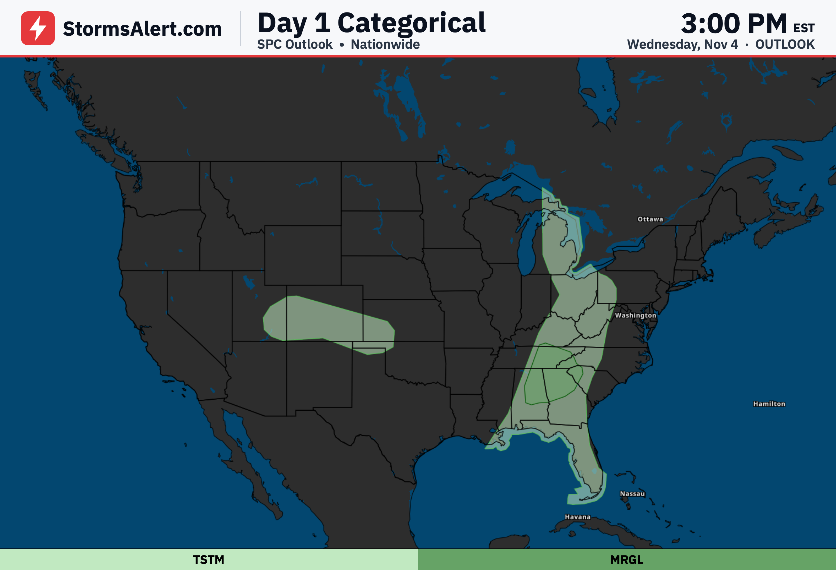
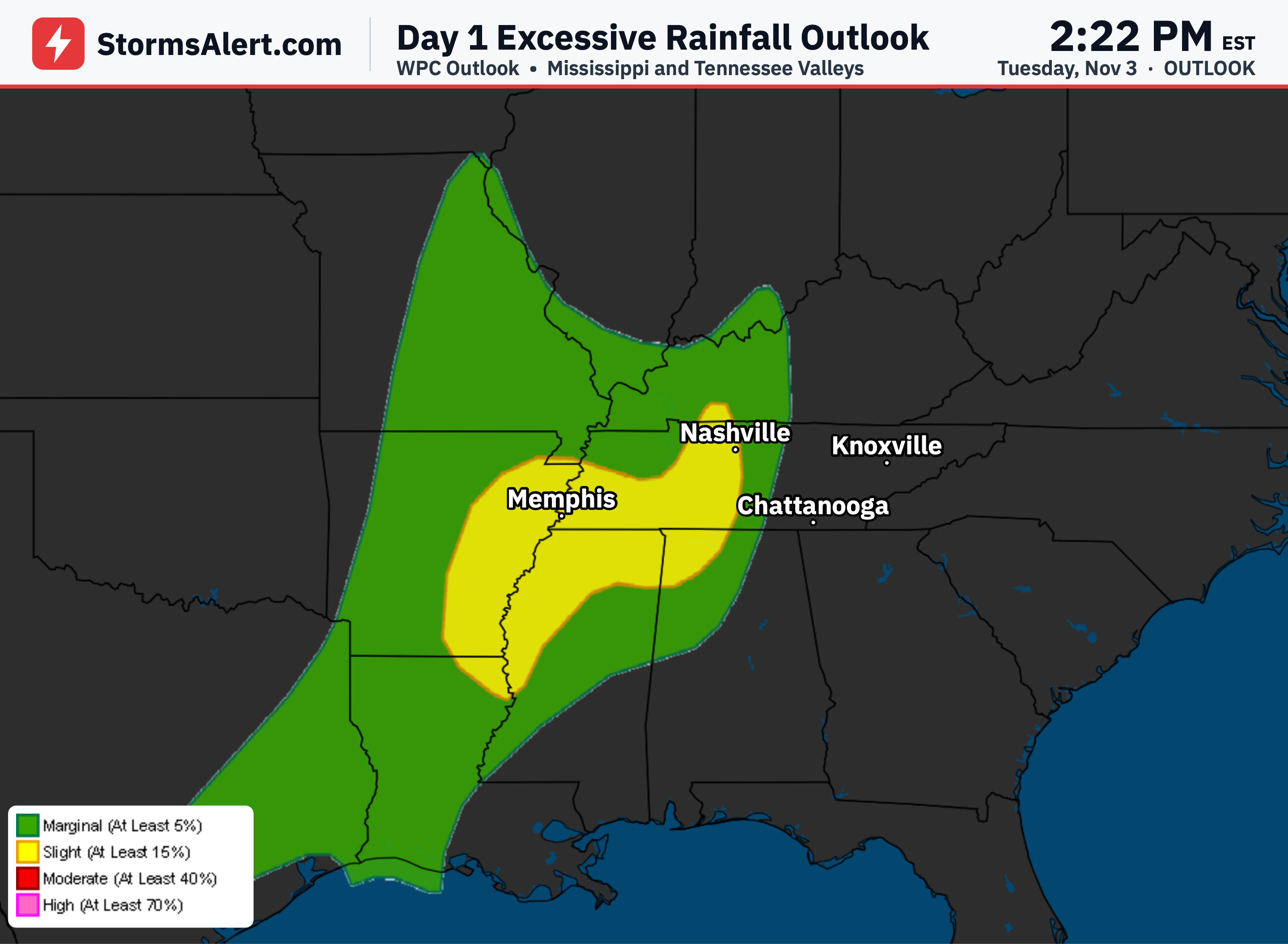
On Wednesday, November 4th, into early Thursday, November 5th, a slow-moving cold front will bring showers and a few thunderstorms across the Ohio and Tennessee Valleys and into the Southern Appalachians. Moisture from the Gulf could produce rainfall rates of 1 to 1.5 inches at times. The ground has stayed quite dry from little rain in the second half of October, so the overall threat stays limited. A Marginal risk means isolated flash flooding is possible, mainly around low water crossings, small creeks, and a bit more in the hills of the Southern Appalachians where terrain can wring out extra rain.
Southeast Florida
Also on Wednesday, November 4th, into early Thursday, November 5th, light onshore flow will support localized heavy downpours near the urban corridor from West Palm Beach to Miami. Storms are expected to be more isolated than in recent days, yet soils in this area are already fully saturated from over a week of rain, so any new rainfall can quickly turn to runoff on city streets. A Marginal risk means isolated flash flooding is possible in and near those urban spots. Drier air should begin moving in by early Thursday and ease the threat.
Nationwide
Thursday, November 5th, into early Friday, November 6th, the chance of rainfall heavy enough to cause flooding is less than five percent across the country. No significant excessive rainfall threats are expected during this stretch, so most areas should stay free of flash flood concerns.
Southern New England
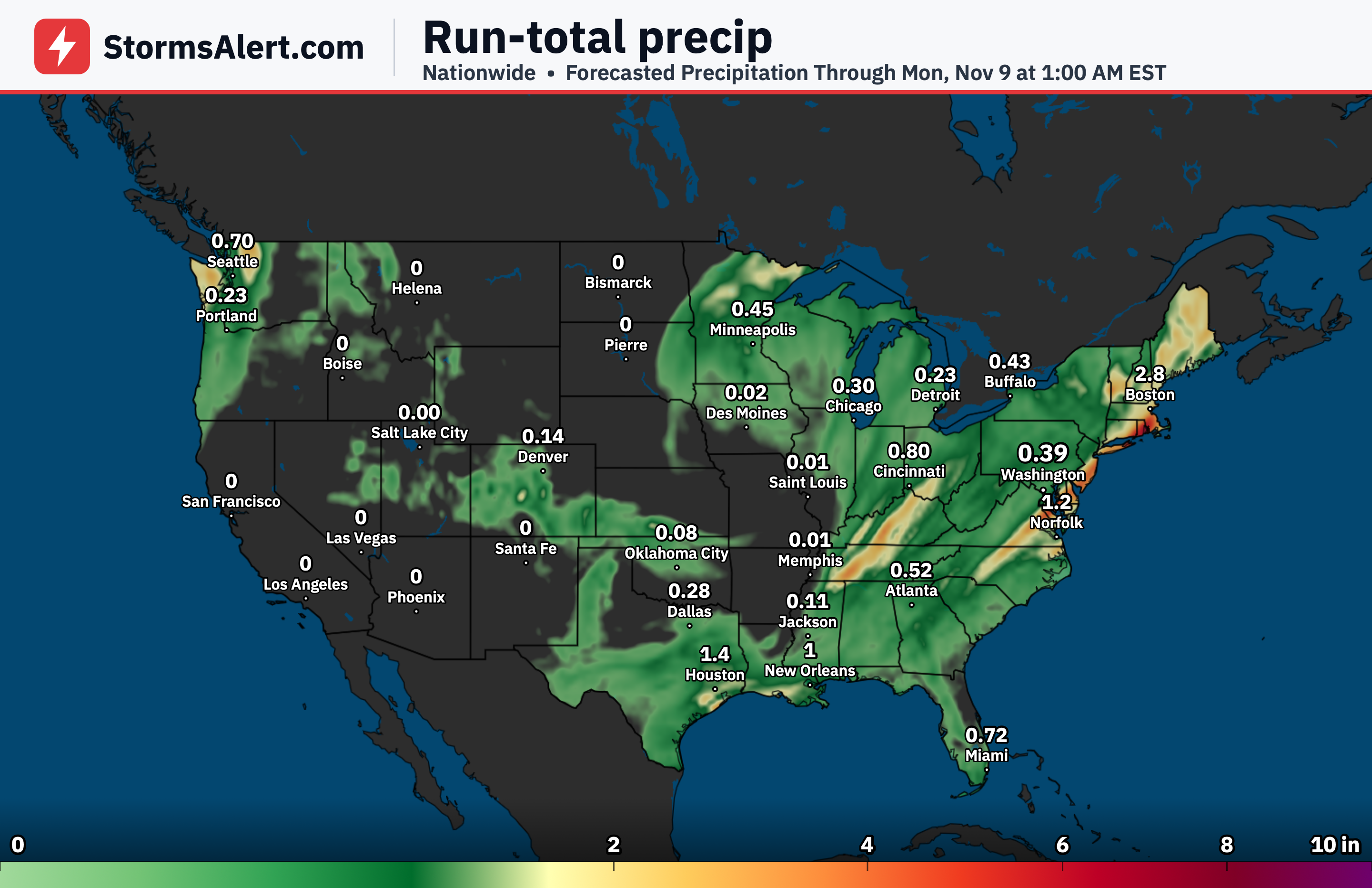
Friday, November 6th, into early Saturday, November 7th, a Marginal risk covers southern New England along with the New York City area and Long Island. A band of rain totaling 1.5 to 2.5 inches or more is forecast along and east of a cold front, with the heaviest amounts most likely from eastern Long Island through southern New England. Even after a stretch of dry weather, isolated flash flooding is possible in urban spots and places with poor drainage. A wave of heavier rain may push a bit farther west toward New York City for a time Friday afternoon before shifting east and ending.
Southern Texas
Saturday, November 7th, into early Sunday, November 8th, a Marginal risk is in place for portions of southern Texas as a weather system moves in and draws extra moisture northward. Areas of heavy rain are expected, with the best chances along the south Texas coast where onshore flow could focus higher totals. A Marginal risk means isolated flash flooding is possible in low-lying spots if heavier rates develop, though the exact details are still coming into better focus.